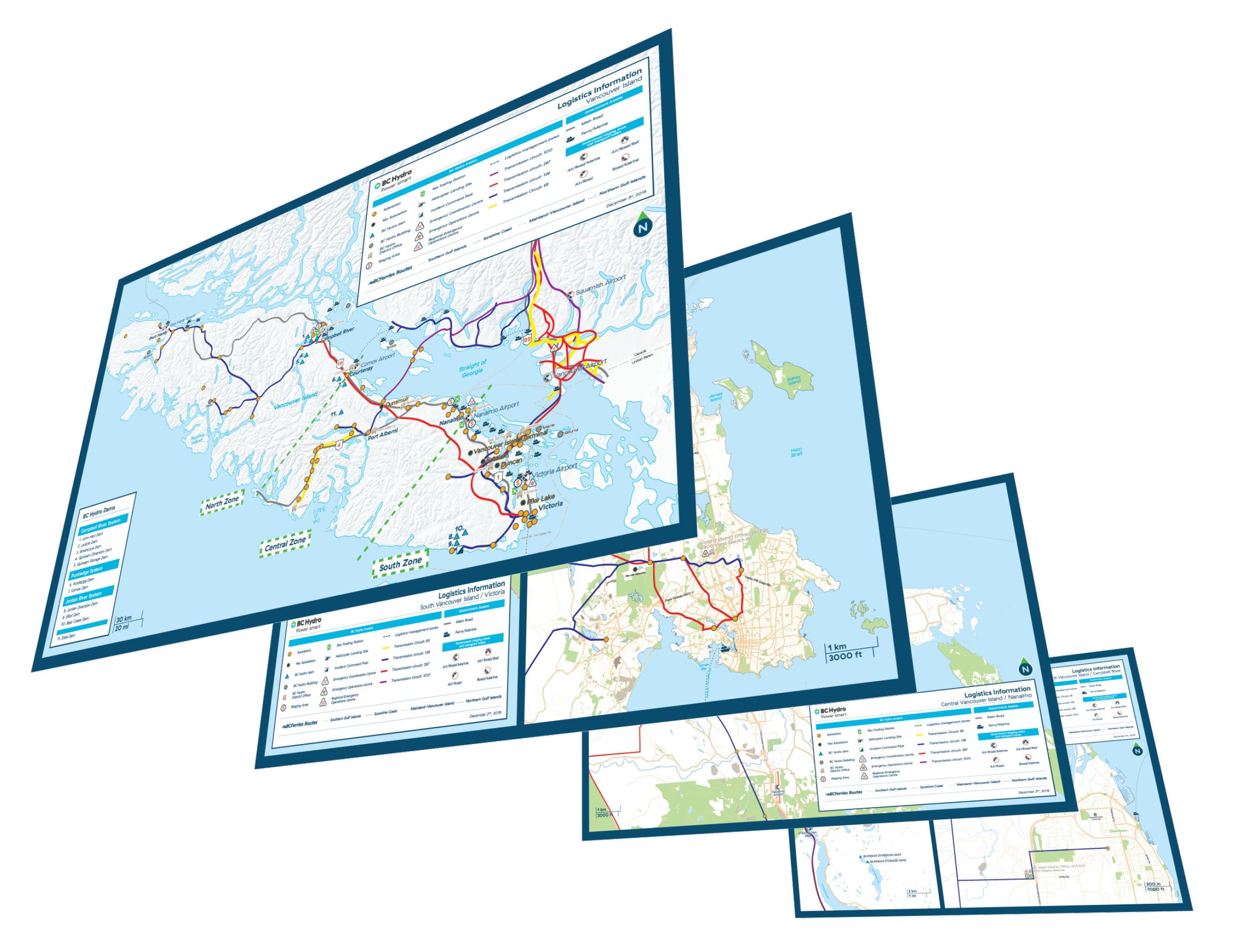
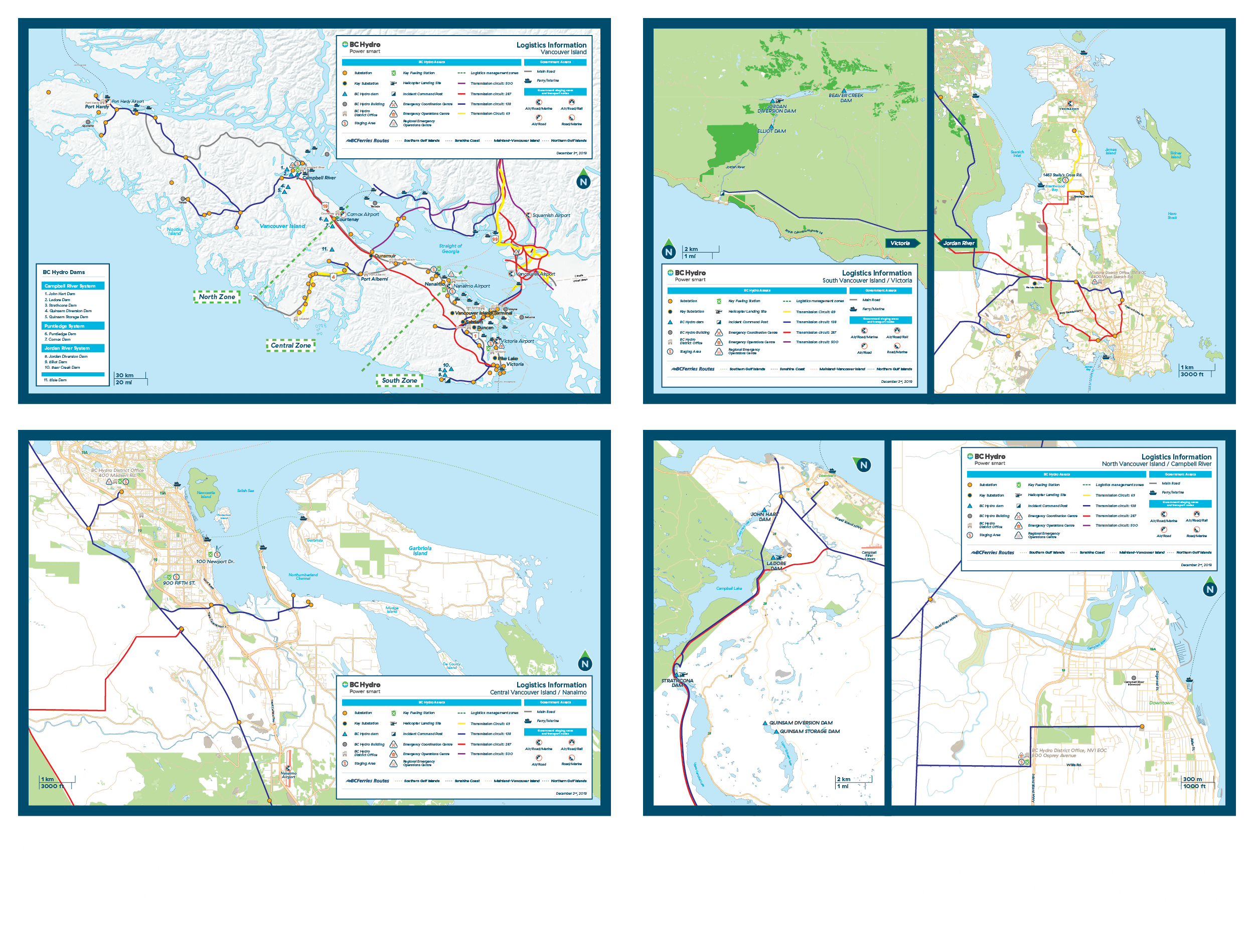
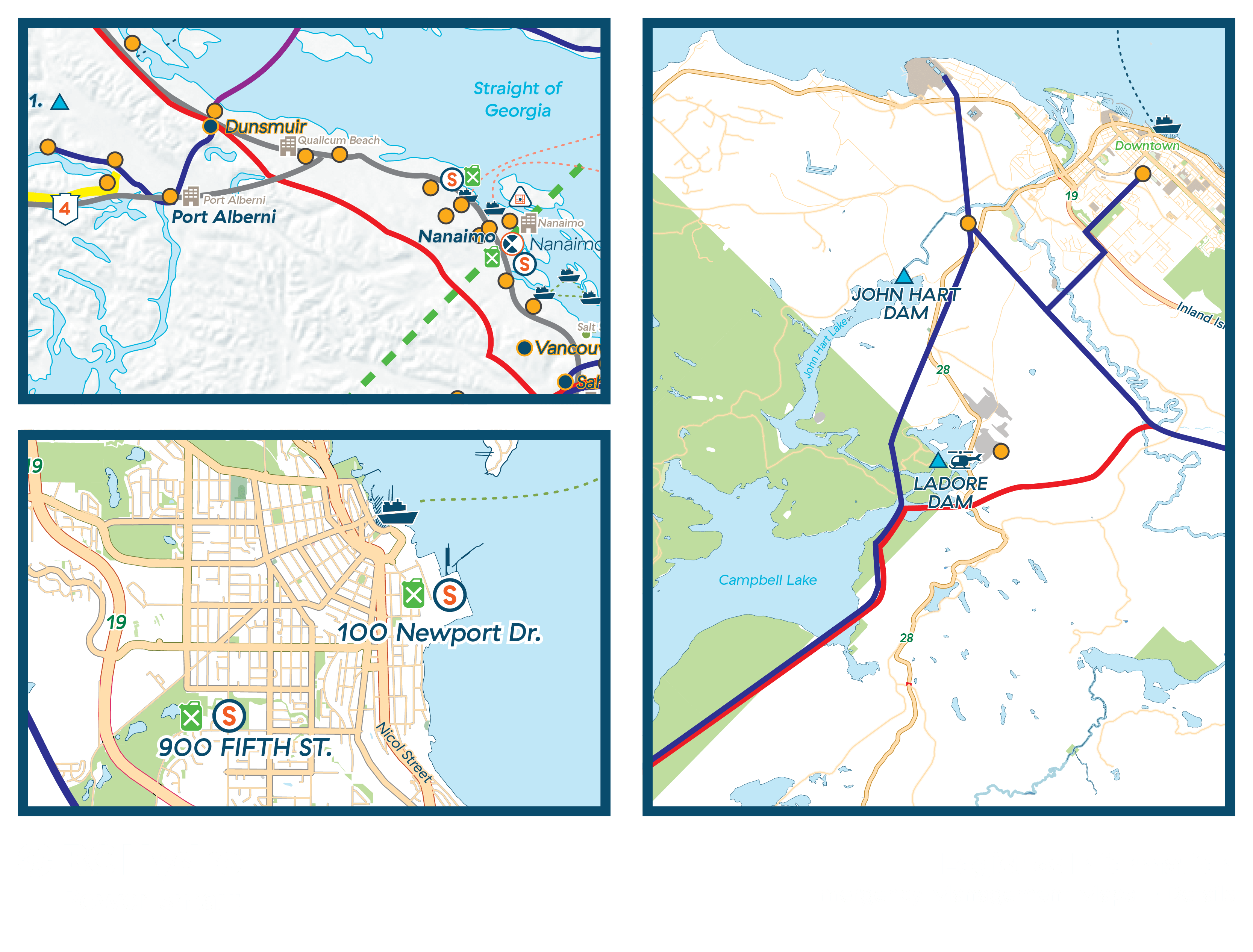
BC Hydro
Location Mapping
Maps designed for BC Hydro to indicate locations of substations, staging areas, and other important locations and pathways.
These were developed by using vector exports of locations from OpenStreetMap, removing all unnecessary information on them, then placing all information and markers required for BC Hydro.
For the Vancouver Island map, a bas relief map was used to emphasize its scale in relation to the other four mapped locations, as well as to visually distinguish it from afar.